About us
At JC Aerial Services LLC, we are a premier Drone Service Provider, utilizing cutting-edge aerial technology to deliver high-resolution imagery and videos for a wide range of applications—from advertising and content creation to technical imagery for mapping, modeling, and inspection solutions.
We actively partner with industry leaders to enhance our residential and commercial roofing inspections and precision mapping services, ensuring that businesses and property owners receive accurate, data-driven insights to make informed decisions.
Using industry-leading platforms like Pix4D and Maps Made Easy, along with RTK-enabled drones, we aim for precision and efficiency in every project. Whether you need detailed aerial surveys, construction site monitoring, or AI-powered roof analysis, our team is committed to delivering actionable insights from a whole new perspective.
Services
We provide imagery and video for various clientele.
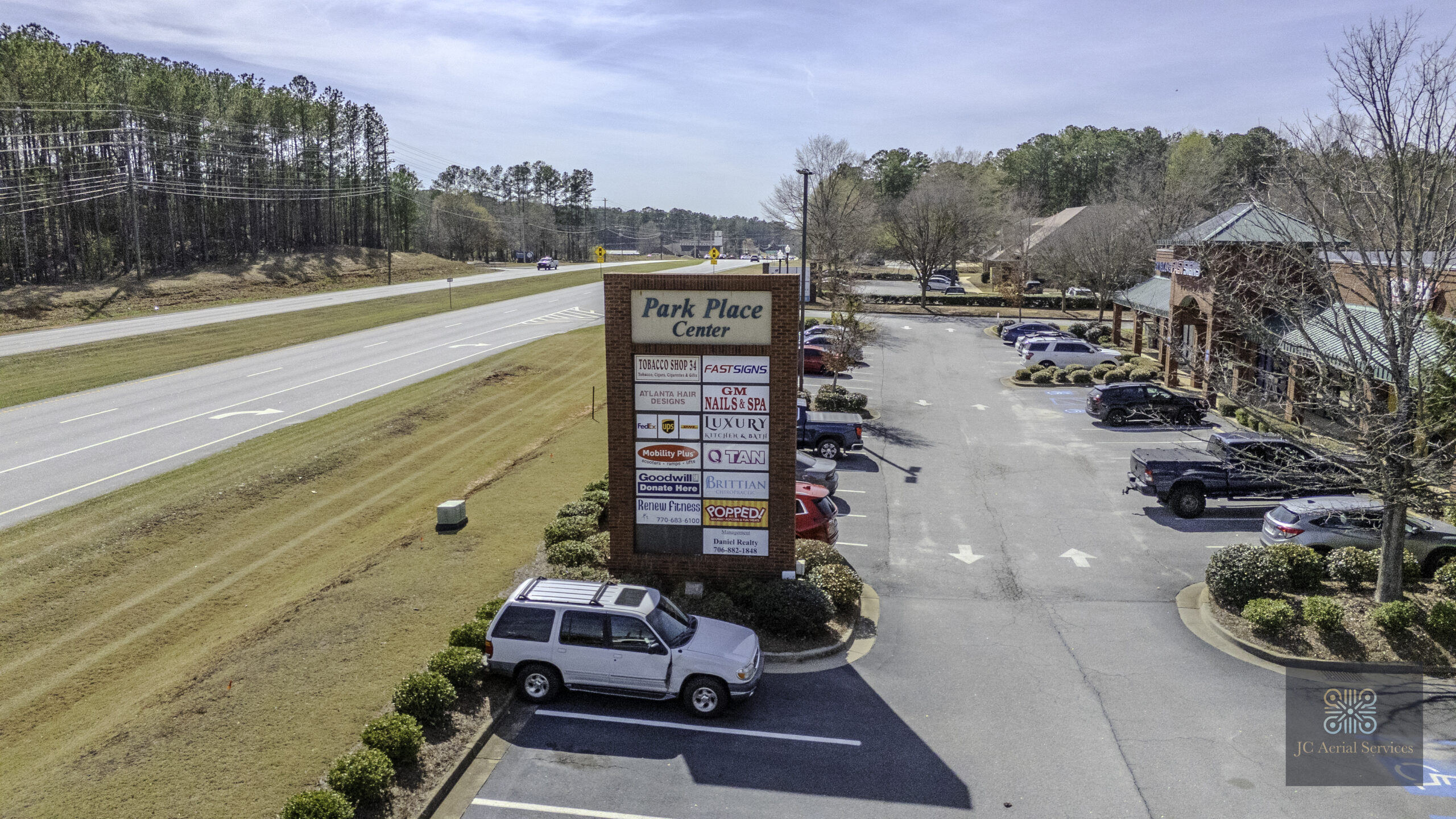
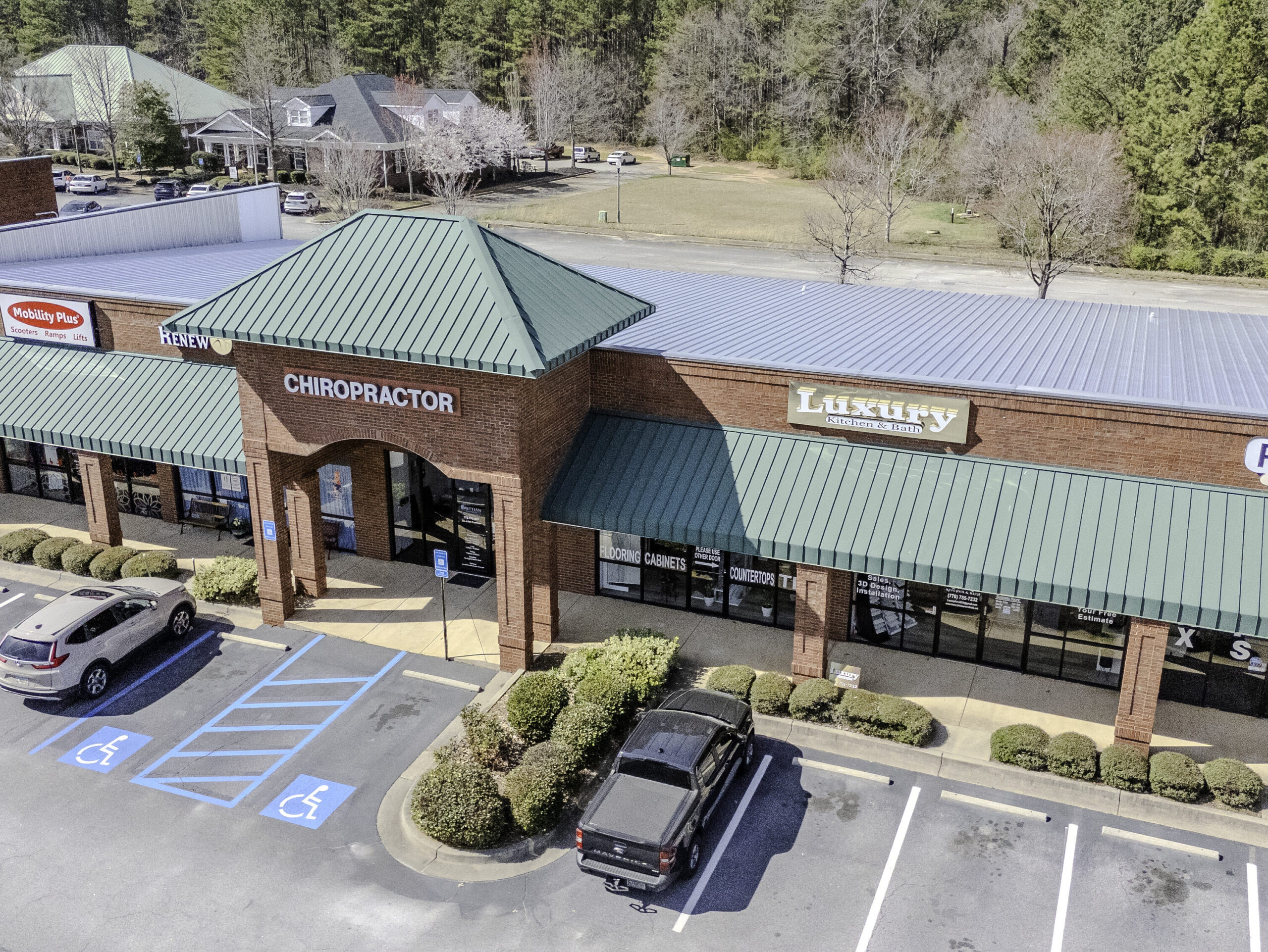
Commercial Real Estate
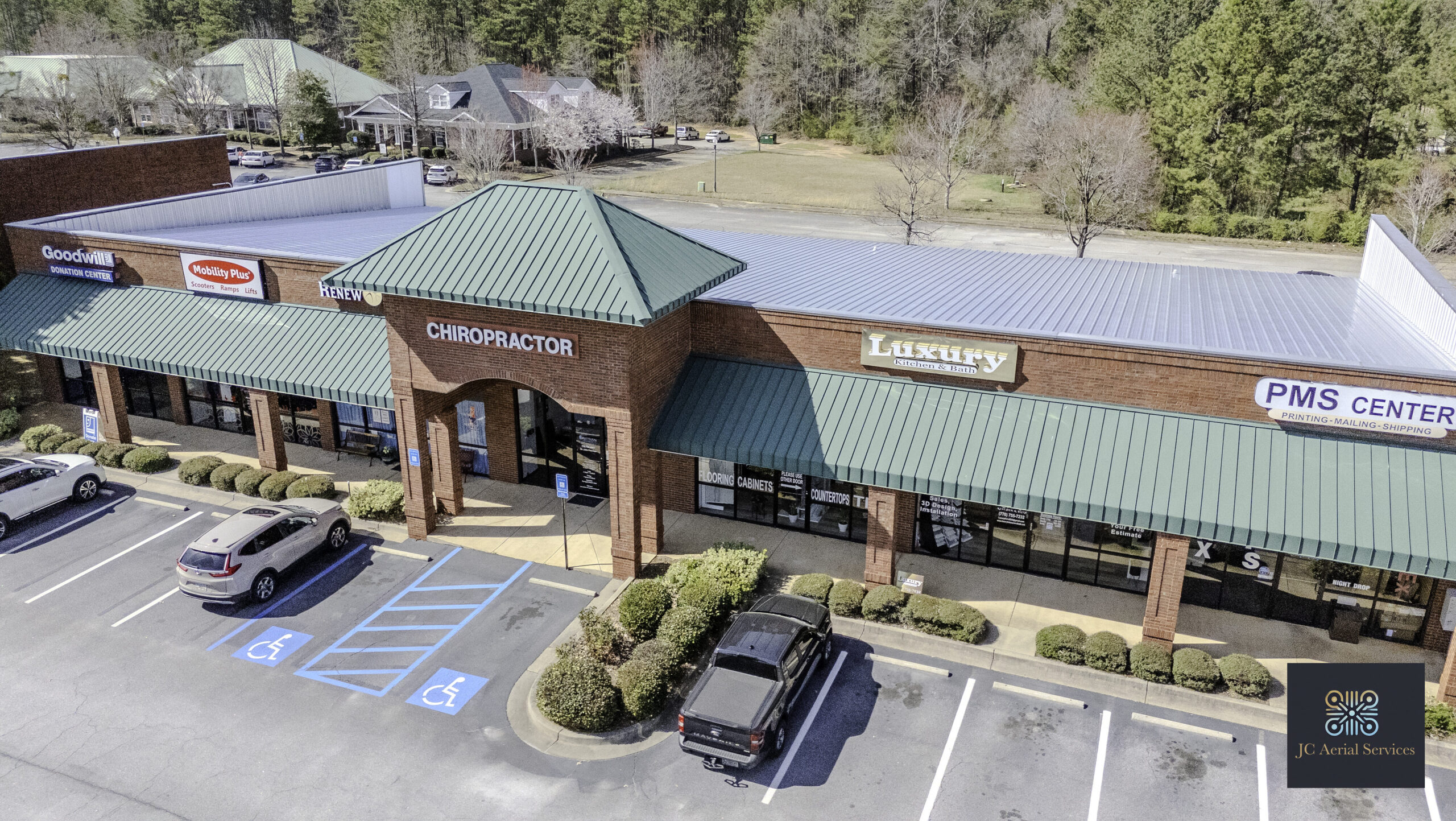
Capture stunning aerial photos and videos to showcase commercial properties and their surroundings. Highlight key features, accessibility, and nearby amenities to attract buyers and investors. Elevate your listings with high-quality visuals that make an impact.
Let us take your real estate marketing to new heights!
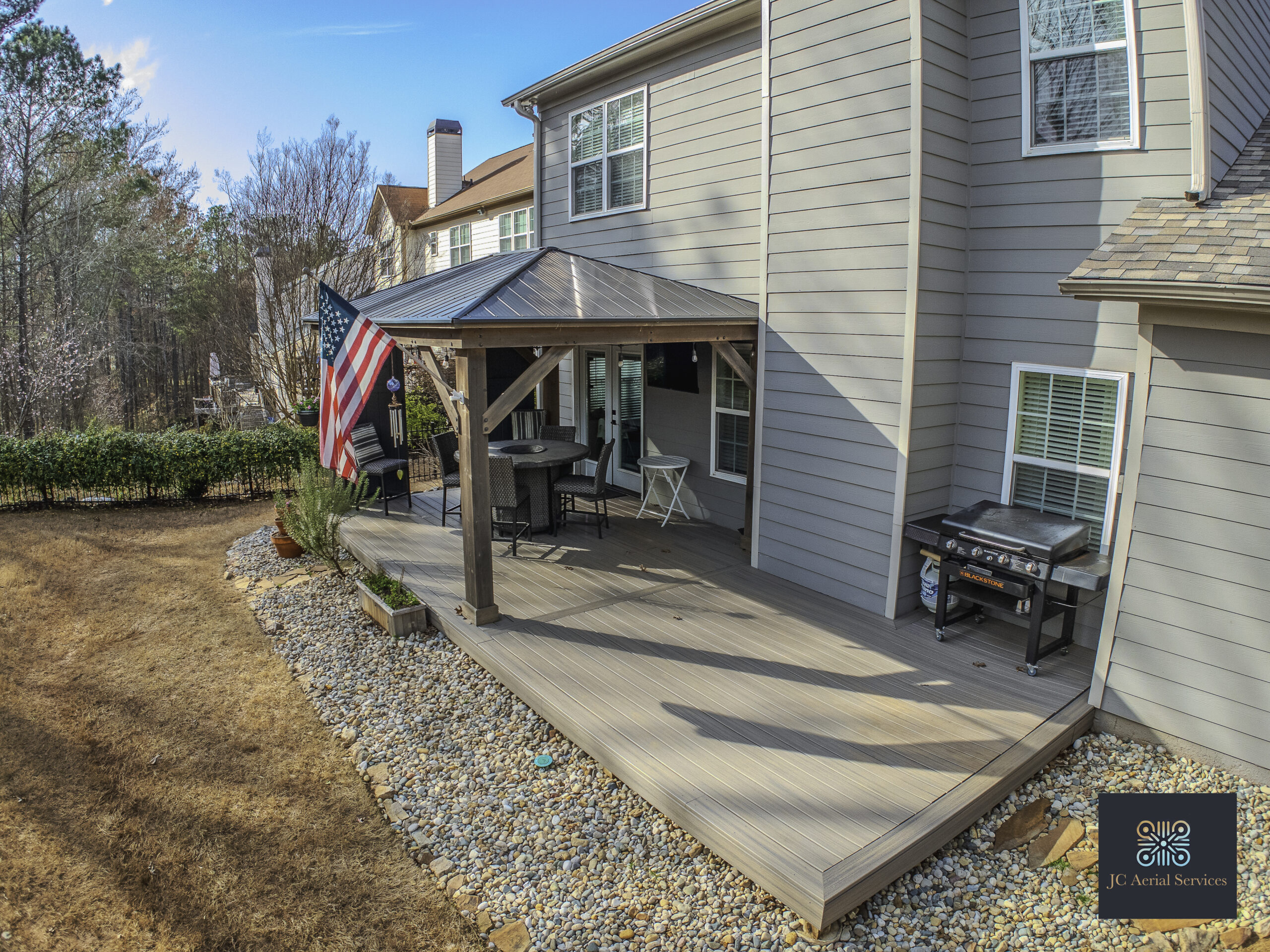
Residential Real Estate
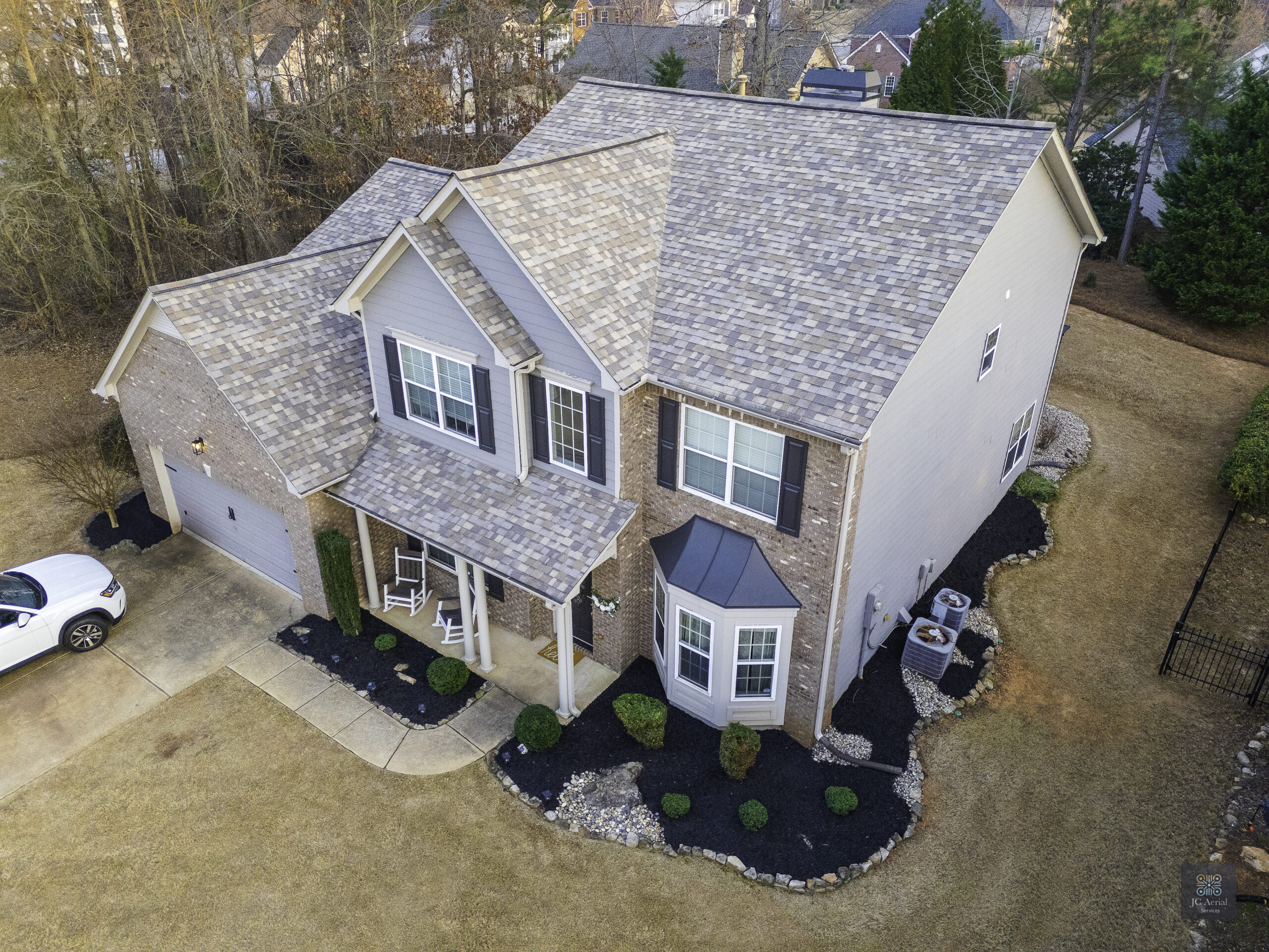
Elevate real estate listings with captivating aerial photography and videos that highlight property features, lot sizes, neighborhoods, and nearby attractions.
These unique perspectives tell visual stories that make listings stand out, increase buyer interest, and drive engagement. Let us showcase homes from above!
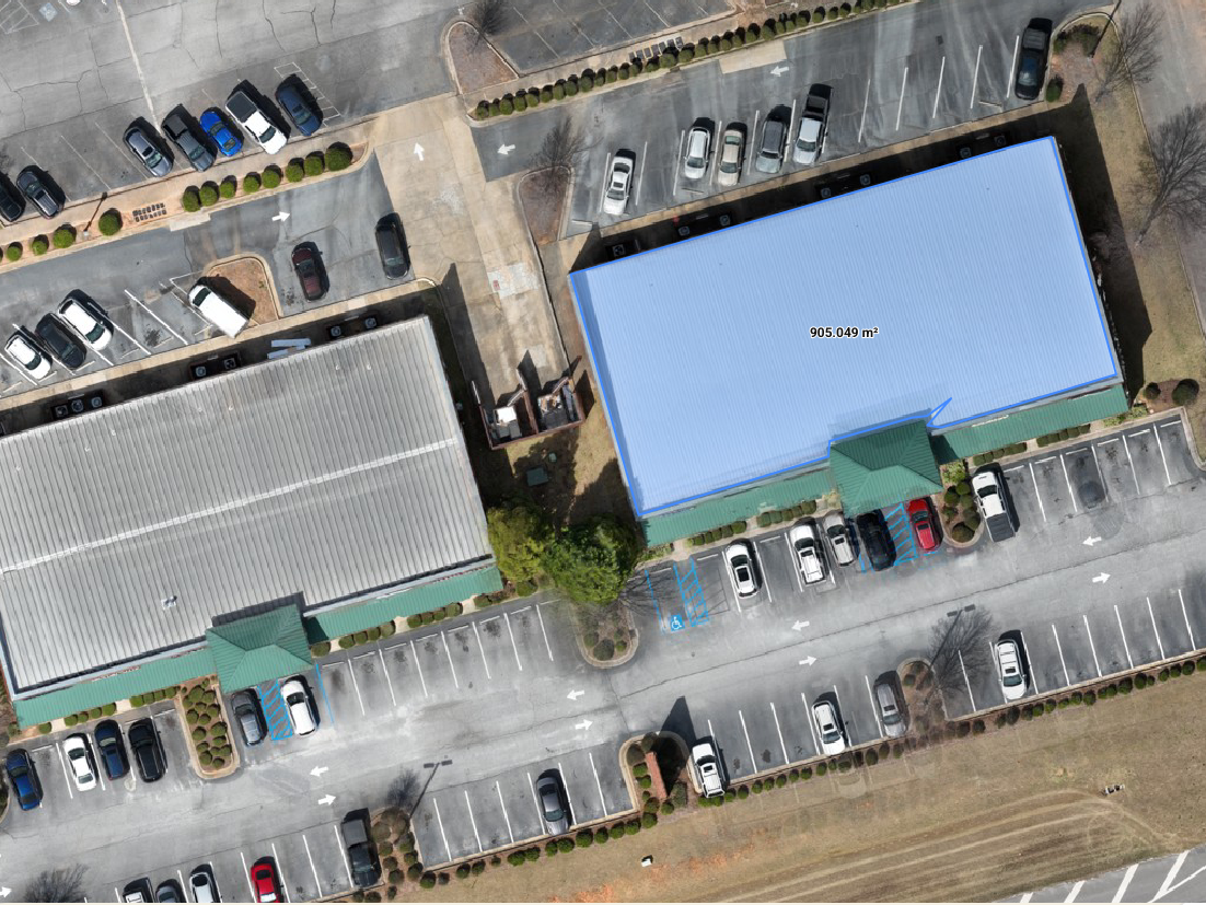
Drone Inspection Services
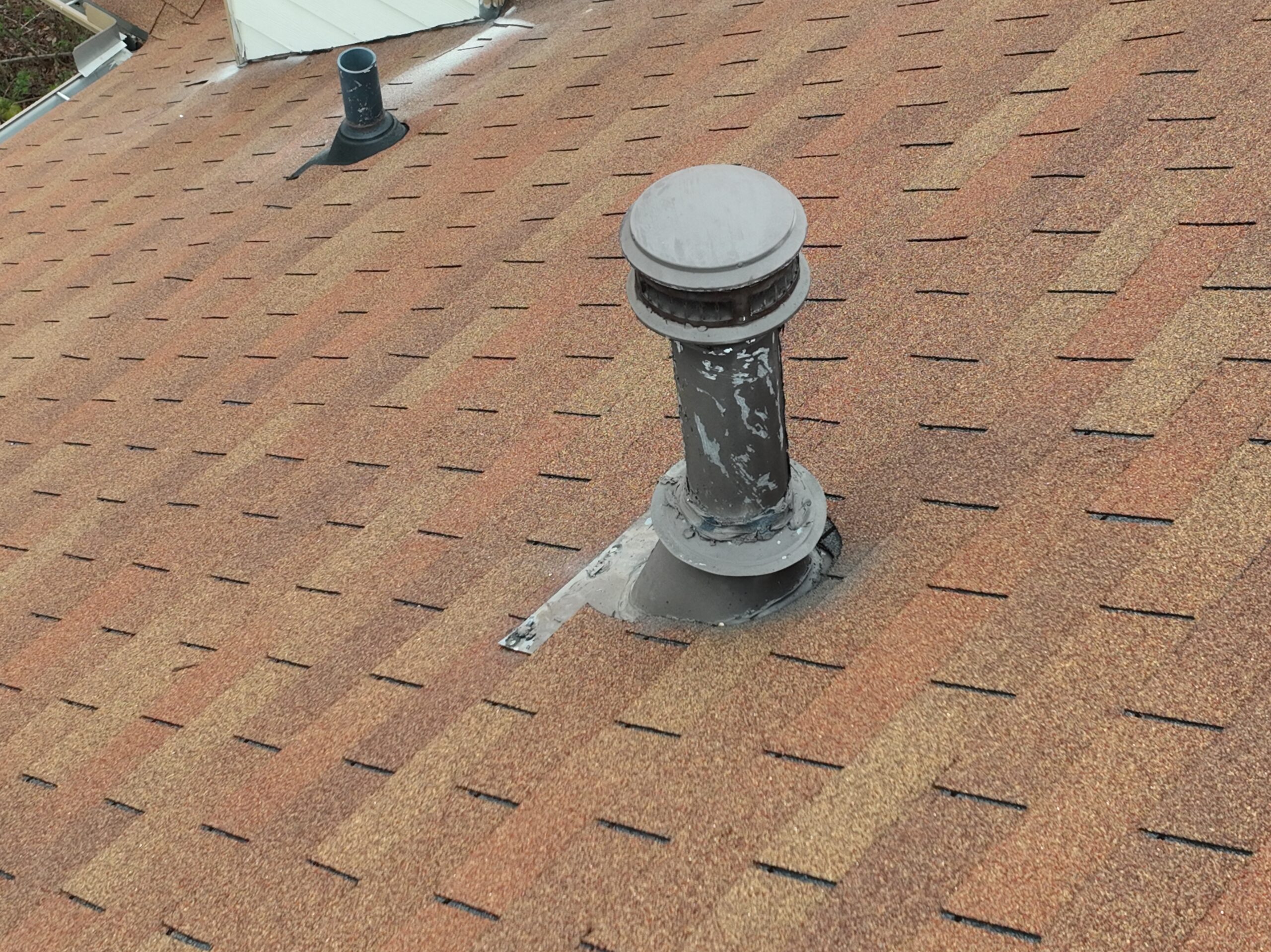
Our high-resolution drone roof scans provide detailed assessments for insurance claims, inspections, and roofing companies.
Serving homeowners, building owners, insurance adjusters, roofers, and property managers with cutting-edge aerial insights that make inspection processes safer and more efficient. Get precise, reliable data with confidence.
Advertising/Marketing Content
Elevate your brand with captivating aerial footage from JC Aerial Services LLC.
Our drone-captured videos provide unique perspectives of your business, properties, and projects—perfect for enhancing social media marketing and traditional advertising campaigns.
Community/Tourism Videos

Elevate your city’s profile with stunning drone footage capturing skylines, communities, and landmarks.
JC Aerial Services LLC delivers high-resolution aerial videos ideal for tourism promotion, economic development initiatives, and engaging social media content.
Enterprise/Industry
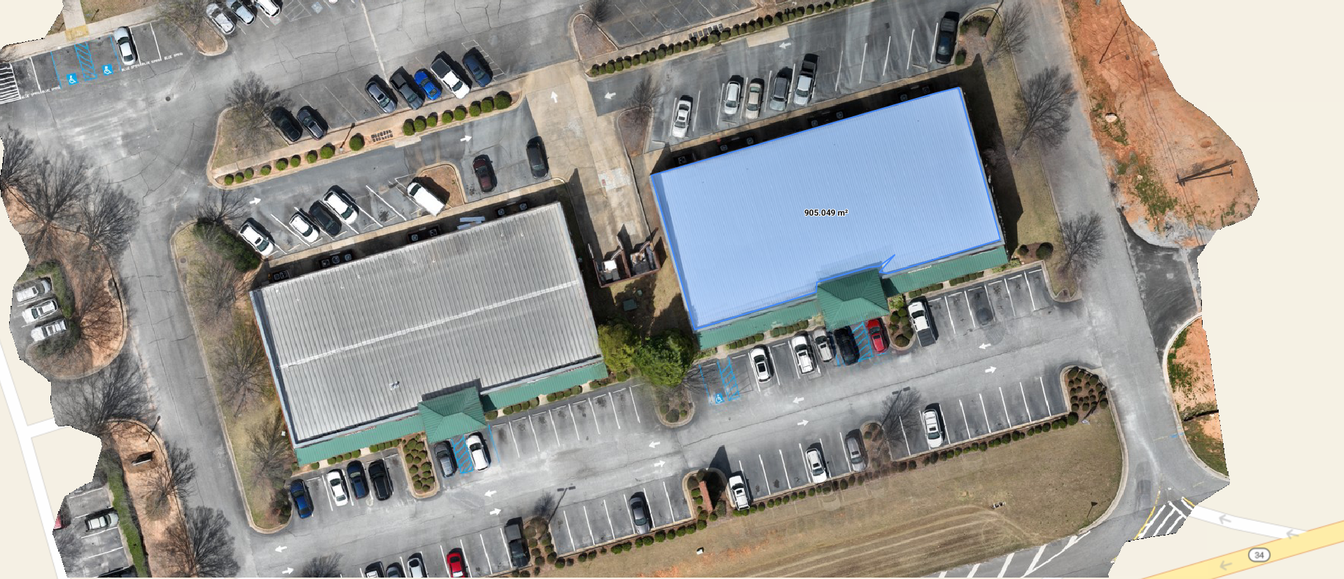
RTK Core networks, Ground Control Points, and tools like Emlid enhance aerial data precision for construction, landscaping, and architecture. Services include high-resolution mapping, 3D modeling, and geospatial analysis that integrate with CAD software.
Disclaimer: These services complement but don’t replace certified surveying work.
How It Works
Plan the project
Complete the contact form or call to get a free consultation and quick quote.
We will gather important details like the project’s location, type of media to capture and scope of project, and what deliverables are needed for your business/project.
Schedule Flight
Once we have agreed on the project requirements and details, our certified pilot will plan the flight, taking into account weather conditions, airspace regulations, and local laws.
A deposit will be required, with details discussed during this stage.
Deliverables
Drone images and videos will be shared with the client in their raw form or processed, depending on the specific project requirements.
Processed deliverables may include high-resolution orthomosaic maps, 3D models, and topographic aerial surveys, created using industry-leading software like Pix4D, Loveland Images, etc.
What are you waiting for?
Ready to take the next step? Let’s bring your vision to life! Explore our services and get in touch today for a free consultation. Together, we’ll make it happen.
Contact us
Contact us for Free Consultation